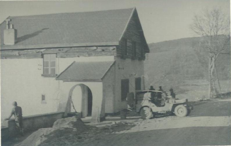
36th Armored Infantry Regiment soldiers occupy a building in Borgoumont, Belgium in December 1944. Location identified by Benno Deckers of La Gleize, Belgium.
The same building as it appears now. Photo taken by Benno Deckers, La Gleize, Belgium on January 10, 2007.
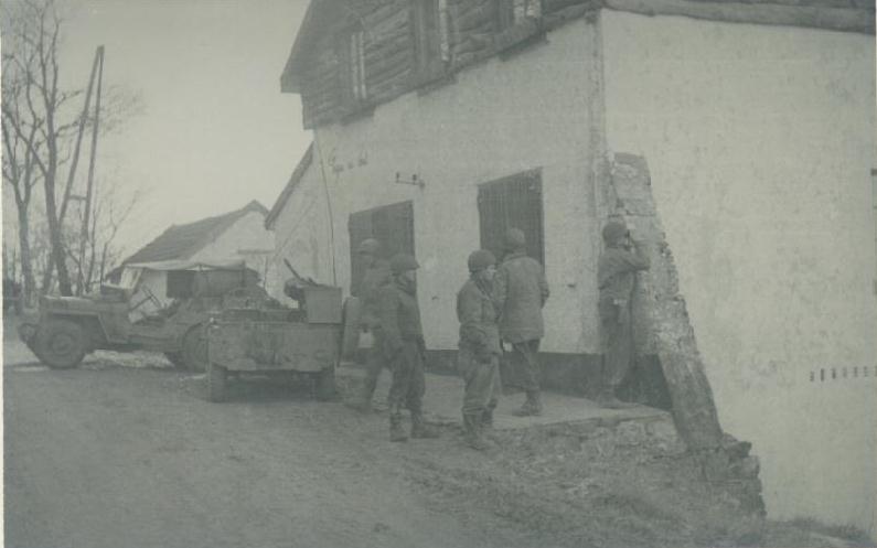
Another view of the same building, December, 1944.
Another view of the same building as it appears today. Photo taken on January 10, 2007 by Benno Deckers.
Special thanks to Benno Deckers of La Gleize, Belgium for identifying the location of these buildings, and for going to the buildings and taking the modern photos shown here.
View of the terrain to the southwest taken from the road to the northeast of the building. December 1944
The same view on January 22, 2007. Trees have grown up obscuring the view to the south. Photo taken by Benno Deckers of La Gleize, Belgium.
This photo was taken from approximately the front of the building shown above, and is a view looking northwest to the gatehouse of a sanitorium/hospital about 100 meters away.
The same view, January 22, 2007. Photo by Benno Beckers of La Gleize, Belgium.
A more complete view of the front of the gatehouse. Photo taken January 22, 2007 by Benno Deckers of La Gleize, Belgium.
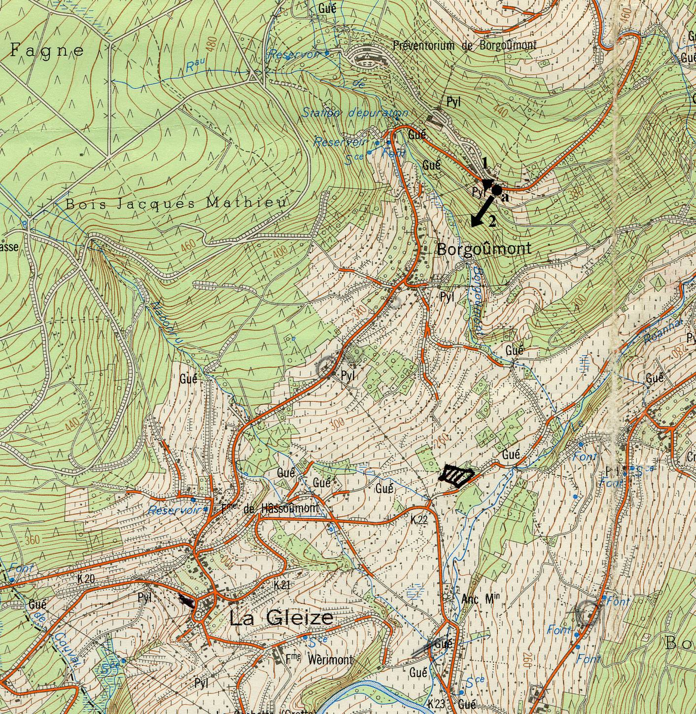
Map provided by Benno Deckers showing the location of the buildings shown above. The circle shows the location of the single house used as an observation post, and the short arrow with numeral 1 points northwest toward the hospital gatehouse. The long arrow and numeral 2 show the direction of the view of the terrain shown in the third WWII photo. The hospital itself can be seen on the map northwest of circle and named "Preventorium de Borgoumont."
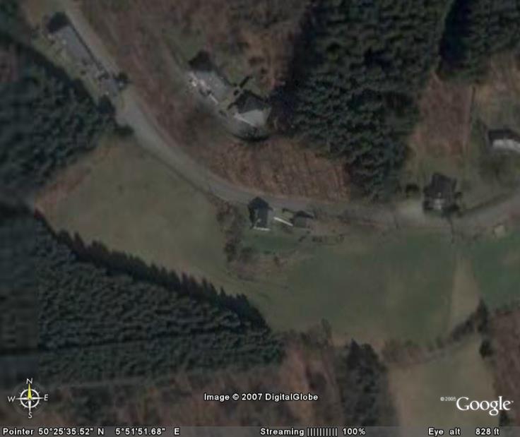
Google Earth image of the area. The first building is in the center of the image, and the gatehouse is in the upper left corner. Image located on Google Earth by Ron Petrovich.
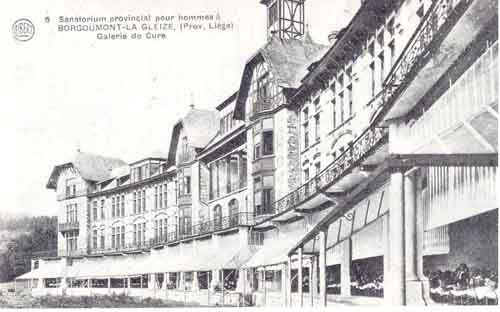
A view of the sanitorium itself. Photo provided by Benno Deckers, La Gleize, Belgium.